Property Record
Bells Ferry Rd, Woodstock, GA 30189
Current Lease Availabilities
NEARBY LISTINGS FOR SALE OR LEASE
Property Detail
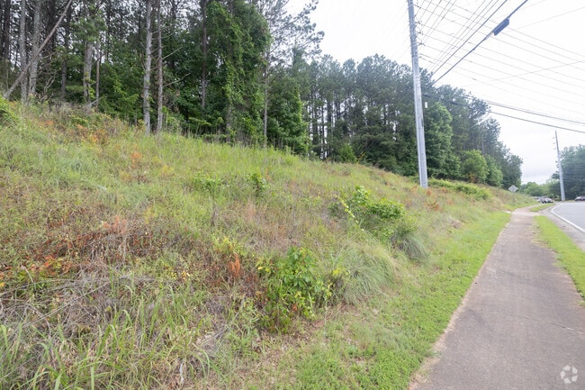
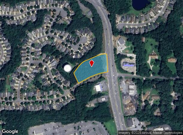
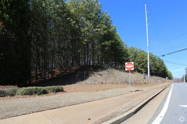
Bells Ferry Rd
Atlanta-Sandy Springs-Roswell, GA
Heritage Towne Lake Sub
015N05-00000-005-000-0000
LL 901 & 902 21ST D
Industrialgeneral
Cherokee
X
Georgia
13057C0327E
1.40 AC
2025
Cherokee County
2025
Atlanta
091006
DEMOGRAPHICS near Bells Ferry Rd
1 Mile
3 Mile
5 Mile
2024 Total Population
9,016
63,870
152,763
2029 Population
9,774
69,478
163,082
Pop Growth 2024-2029
+ 8.41%
+ 8.78%
+ 6.75%
Average Age
39
40
39
2024 Total Households
3,099
22,916
55,594
HH Growth 2024-2029
+ 8.26%
+ 8.75%
+ 6.77%
Median Household Inc
$110,789
$101,875
$102,251
Avg Household Size
2.90
2.70
2.70
2024 Avg HH Vehicles
2.00
2.00
2.00
Median Home Value
$389,032
$394,692
$393,283
Median Year Built
1995
1995
1995
Nearby Places
- Restaurants
- Banks
- Shops
- Fitness
- Groceries
Nearby Properties
Address
Land Use
TOTAL SIZE
Lot Size
Zoning
Address
Land Use
TOTAL SIZE
Lot Size
Zoning
523,803 SF
148.37 AC
R-40
Address
Land Use
TOTAL SIZE
Lot Size
Zoning
56,439 SF
13.69 AC
GC
Address
Land Use
TOTAL SIZE
Lot Size
Zoning
189,621 SF
12.16 AC
R-40
Address
Land Use
TOTAL SIZE
Lot Size
Zoning
309,011 SF
64.20 AC
PUD
Address
Land Use
TOTAL SIZE
Lot Size
Zoning
175,587 SF
17.71 AC
RTH
Address
Land Use
TOTAL SIZE
Lot Size
Zoning
201,331 SF
15.48 AC
RM16
Address
Land Use
TOTAL SIZE
Lot Size
Zoning
346,900 SF
104.10 AC
CD
Address
Land Use
TOTAL SIZE
Lot Size
Zoning
235,861 SF
31.92 AC
RM10
Address
Land Use
TOTAL SIZE
Lot Size
Zoning
238,600 SF
21.10 AC
R-3
Address
Land Use
TOTAL SIZE
Lot Size
Zoning
91,547 SF
18.48 AC
R-3
Address
Land Use
TOTAL SIZE
Lot Size
Zoning
255,460 SF
20.28 AC
RM16
Address
Land Use
TOTAL SIZE
Lot Size
Zoning
113,849 SF
7.46 AC
R-5
Address
Land Use
TOTAL SIZE
Lot Size
Zoning
12,032 SF
17.14 AC
RM16
Address
Land Use
TOTAL SIZE
Lot Size
Zoning
85,671 SF
12.25 AC
RM10
Address
Land Use
TOTAL SIZE
Lot Size
Zoning
194,729 SF
29.67 AC
GC
Address
Land Use
TOTAL SIZE
Lot Size
Zoning
134,017 SF
32.51 AC
AG
Address
Land Use
TOTAL SIZE
Lot Size
Zoning
117,247 SF
21.44 AC
PUD
Address
Land Use
TOTAL SIZE
Lot Size
Zoning
107,514 SF
16.17 AC
LI
Address
Land Use
TOTAL SIZE
Lot Size
Zoning
216,432 SF
16.79 AC
LI
Address
Land Use
TOTAL SIZE
Lot Size
Zoning
2,768 SF
60 AC
PUD
Address
Land Use
TOTAL SIZE
Lot Size
Zoning
77,924 SF
9.84 AC
GC
Address
Land Use
TOTAL SIZE
Lot Size
Zoning
3,870 SF
98.57 AC
R-40
Address
Land Use
TOTAL SIZE
Lot Size
Zoning
28,438 SF
GC
Address
Land Use
TOTAL SIZE
Lot Size
Zoning
138,918 SF
13.96 AC
GC
Address
Land Use
TOTAL SIZE
Lot Size
Zoning
33,920 SF
1.78 AC
GC
Address
Land Use
TOTAL SIZE
Lot Size
Zoning
108,860 SF
10.98 AC
LI
Address
Land Use
TOTAL SIZE
Lot Size
Zoning
176,894 SF
11.54 AC
NC
Address
Land Use
TOTAL SIZE
Lot Size
Zoning
92,945 SF
24.79 AC
R-40
Address
Land Use
TOTAL SIZE
Lot Size
Zoning
135,998 SF
13.28 AC
GC
Address
Land Use
TOTAL SIZE
Lot Size
Zoning
71,682 SF
5.46 AC
RM10
The World's #1 Commercial Real Estate Marketplace
Connect with us
© 2025 CoStar Group
The information above has been obtained from sources believed reliable. While we do not doubt its accuracy we have not verified it and make no guarantee, warranty or representation about it. It is your responsibility to independently confirm its accuracy and completeness. Any projections, opinions, assumptions, or estimates used are for example only and do not represent the current or future performance of the property. The value of this transaction to you depends on tax and other factors which should be evaluated by your tax, financial, and legal advisors. You and your advisors should conduct a careful, independent investigation of the property to determine to your satisfaction the suitability of the property for your needs.